Historic floods across country prompt concern for local expert
Aug 26, 2022, 1:01 PM
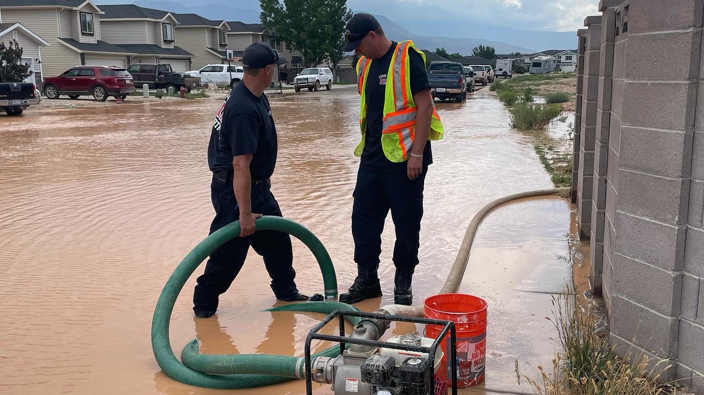
Cedar City broke out pumps and heavy equipment after flash floods sent a river of debris to overflow the bed of Coal Creek. Photo: Maile Wilson-Edwards
SALT LAKE CITY — Floods across the U.S. are occurring this year in historic quantities. There have been five 1 in 1,000-year floods all within the months of July and Aug.
KSL TV meteorologist Mathew Johnson said that in these areas “there is usually a .1 percent chance of seeing this magnitude of flood on any given day of the year.”
Count ‘em! FIVE 1 in 1,000 year flood events from Kentucky to Death Valley! All happening in just a month’s time. Absolutely insane… ⛈🤯 @KSL5TV @kslnewsradio pic.twitter.com/pQl38nICGS
— Matthew Johnson (@KSL_Matt) August 23, 2022
Some numbers from Johnson put things in perspective.
“The very historical rainstorm in Death Valley, Aug. 5, they saw 1.46 inches of rainfall within a couple of hours. That’s over 75 percent of their annual rainfall that fell with just a couple of hours.”
Another expert, Dr. Jon Meyer, the assistant state climatologist at the Utah Climate Center, told KSL NewsRadio in an email that these monsoonal thunderstorms are slow-moving and localized. Releasing significant amounts of rain within a few minutes to an hour. Meyer says these conditions spell disaster, especially for areas with dry topsoil.
“You’d think that by being in the middle of a drought and having really dry topsoils, rains would more easily absorb into the ground, but it’s actually the opposite where dry soils become hydrophobic and resist any infiltration,” said Meyer.
Relationship between historic floods and climate change
As air temperature increases, the atmosphere can hold more water vapor said, Meyer. These floods become historic when increased temperatures add more evaporation from oceans and lands into the atmosphere.
“This all works together to supercharge precipitation events as storms are more likely to have more available horsepower from the higher amounts of water vapor that turns into rain,” said Meyer.
Additionally, as temperatures continue to rise around the country, these extreme weather events can become more commonplace said Meyer.
“Because the relationship between air temperature and capacity to hold water vapor is exponential, the risk for these types of events is expected to continue to accelerate towards more and more frequent and extreme values,” said Meyer
Is Utah ready for a historic flood?
Although Meyer and his team completed a study re-evaluating Utah’s probable maximum precipitation estimates, which the state will then use to determine infrastructure safety criteria, Meyer said it is hard to know if the data gathered will be a viable foundation to build upon.
“Due to the shifting of precipitation towards more extreme amounts already observed in recent decades and the expectation for that trend to continue to worsen,” said Meyer. “The question is will our older infrastructure, built using outdated assumptions of worst-case precipitation events, be able to safely handle future extreme precipitation events.”
An example of extreme precipitation events happened this week, which lead Gov. Spencer Cox to issue a state of emergency in Moab and other areas of Utah affected by flooding. Meyer said the main concern is as these extreme weather events become more commonplace, can Utah’s water-management infrastructure keep up?
Related
- National Weather Service announces flood advisory for Enoch and Cedar City
- Americans more likely to see climate crisis as a threat after facing extreme weather
- Severe weather makes its presence felt Friday around Utah


