Where Fiona goes from here as it keeps getting stronger
Sep 20, 2022, 6:30 AM
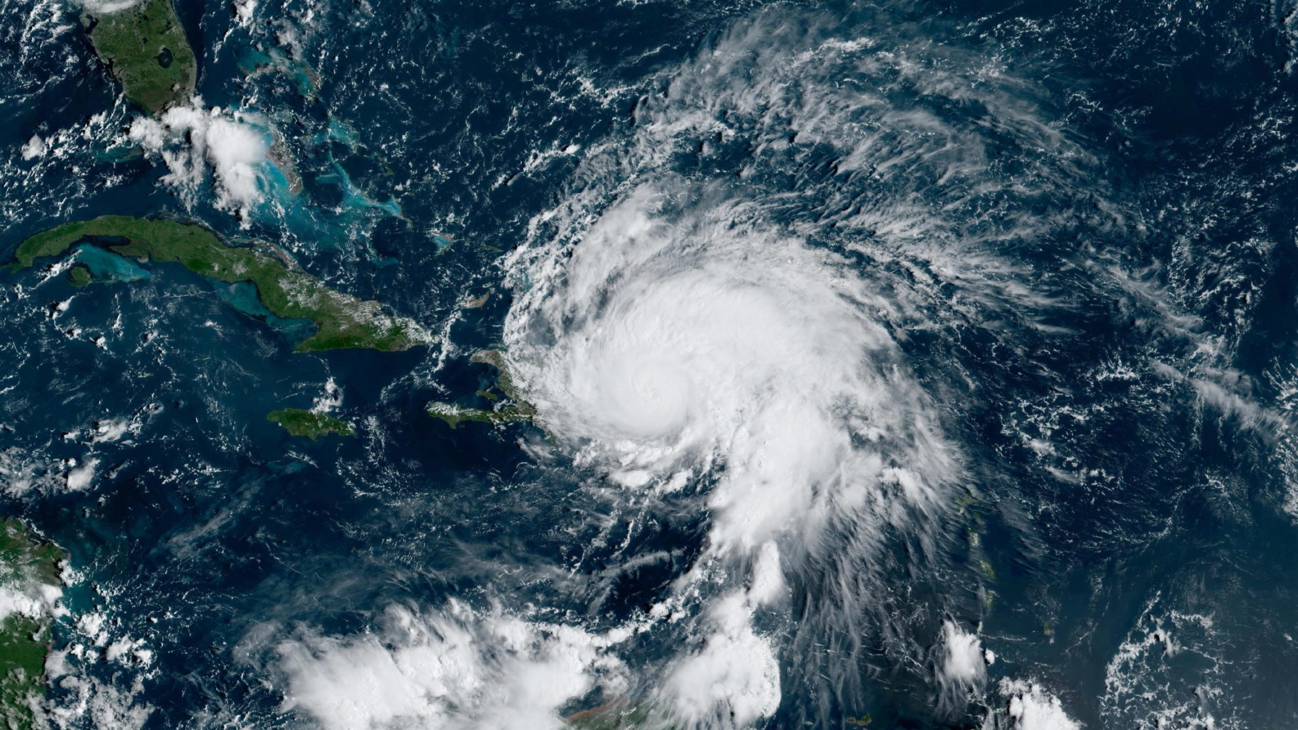
A satellite image of Fiona from the morning of Sept. 19 is pictured here. Photo credit: NOAA.

(CNN) — Three storms wreaked havoc around the world over the weekend. Here is where they are now and where they are heading.
Extreme wind and storm surge from the remnants of a typhoon were powerful enough to uproot buildings in Alaska this weekend, and the storm it is still hanging around.
Hurricane Fiona brought over 2 feet of rain to portions of Puerto Rico, causing rivers to rage, demolishing a bridge in the torrent of water. Fiona caused an islandwide power outage, impacting nearly 1.5 million customers on Sunday. The storm is now forecast to strengthen into the Atlantic season’s first major hurricane.
And after making landfall in southern Japan as a strong typhoon, causing damage and power outages, Nanmadol is turning right and heading up the spine of Japan towards Tokyo. From there, it heads toward Alaska.
Are you impacted by these storms or know someone who is? Bookmark or share CNN’s lite site for fast connectivity.
Hurricane Fiona
Over a foot of rain has fallen in much of Puerto Rico over the past three days. One reporting station north of Ponce reported over 2 feet of rain in the last 24 hours.
That is an astonishing amount. Sometimes as a meteorologist, you wonder, is this really going to happen? You don’t want to cry wolf.
But, on Friday, forecasters at the National Hurricane Center began warning of a foot of rainfall possible in Puerto Rico. By Saturday, they upped the rainfall forecast after seeing how much rainfall the storm produced in Guadeloupe (over 19 inches in 24 hours), providing as much of an advanced warning as possible.
This excessive rainfall forced rivers to rise higher than during Hurricane Maria.
As the storm moves Monday off the northern shore of the Dominican Republic, it will continue to bring flooding rains to Puerto Rico as the storm’s southerly flow draws moisture across the island.
Southern Puerto Rico can expect an additional 4 to 6 inches, with up to 10 inches maximum possible in some locations. That would result in a storm total of 12 to 20 inches of rain, with local maximums of 30 inches across portions of the island.
The center of Fiona will slowly move off the Dominican Republic’s north shore today. As it moves over open water, it is forecast to strengthen as it passes Turks and Caicos on Tuesday.
Wednesday, it is forecast to become the season’s first major hurricane in the Atlantic.
From that day on, it is expected to curve to the northeast and track out to sea, threatening Bermuda later this week.
Landfall in Bermuda isn’t out of the question, but it is like hitting a tiny bull’s eye in a vast ocean.
I won’t feel really comfortable that the US East Coast is out of the woods until Fiona makes the turn in a couple of days and moves northeast.
However, forecast models seem to be in very close consensus that this turn will happen, leaving high surf and rip currents as the potential hazards to the US eastern coastline.