
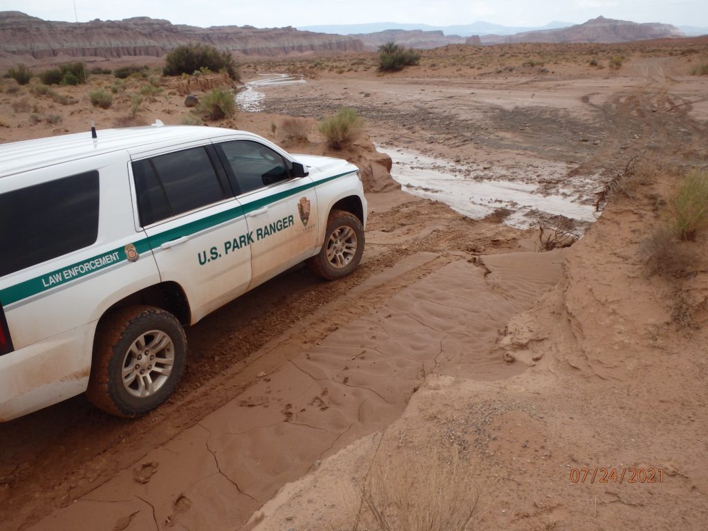
Flash flood warning issued for parts of Garfield, Kane Counties
Jul 24, 2021, 8:13 PM | Updated: 8:25 pm
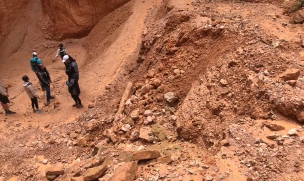
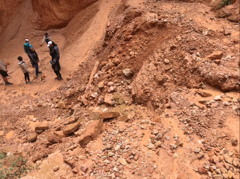
Mudslide pictured at Bryce Canyon National Park on Saturday, July 24. Photo credit: Bryce Canyon National park.
SALT LAKE CITY — The National Weather Service issued a flash flood warning for parts of Garfield and Kane Counties Saturday evening through 11:15 p.m., including the drainage of Bullfrog Creek all the way to its confluence with Lake Powell.
The warning, issued at 8:08 p.m., includes south central Garfield County and northeastern Kane County. According to the NWS alert, thunderstorms moved into the warning area just after 8 p.m. capable of dropping a half-inch to an inch of rain.
A flash flood warning means flooding is either ongoing or is expected to begin shortly.
Flash flood warning caps off wet day for southern Utah
The warning came on top of a day full of alerts from forecasters about the potential for flash flooding in portions of southern Utah.
Under a very moist airmass, the threat of flash flooding remains elevated over southern Utah today. If you have activities planned at one of the national parks today, be prepared for heavy rain! Conditions will be generally dry over northern Utah. #utwx pic.twitter.com/qvsokKkSn3
— NWS Salt Lake City (@NWSSaltLakeCity) July 24, 2021
By early Saturday afternoon, the National Weather Service issued a flash flood warning which included Kane County, Utah, and then for the town of Glendale, where the NWS said two inches (or more) of rain had fallen.
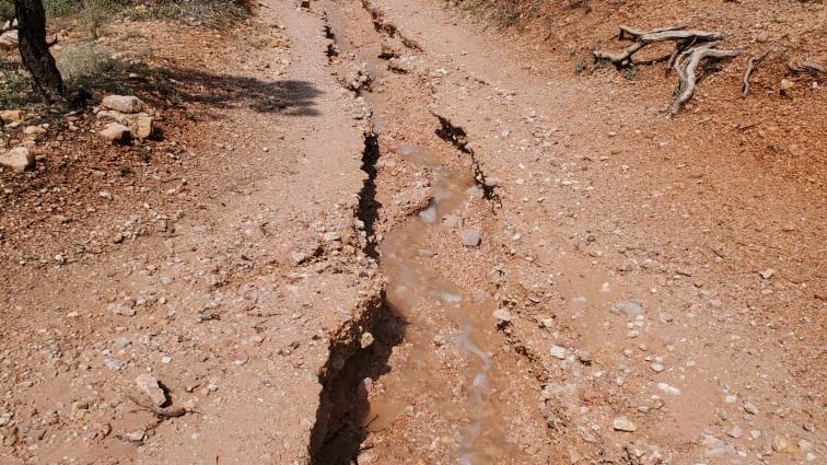
Next, the NWS issued a flash flood warning to include Bryce Canyon, Tropic and Cannonville, Utah, and the city of Hildale, Utah. Hildale was also the subject of a severe thunderstorm warning for a portion of the afternoon on Saturday. That storm was reported to be “nearly stationary near the Pine Valley area, with heavy rain, quarter sized hail, and 60 mph winds expected.”
A severe thunderstorm is nearly stationary near the Pine Valley area with heavy rain, quarter sized hail, and 60 mph winds expected. #utwx https://t.co/QEOrPE9p1M
— NWS Salt Lake City (@NWSSaltLakeCity) July 24, 2021
A look at the thunderstorm near Pine Valley. When Thunder Roars…Go Indoors. Time to Go Indoors. #UTwx pic.twitter.com/UOATndLqXD
— NWS Salt Lake City (@NWSSaltLakeCity) July 24, 2021
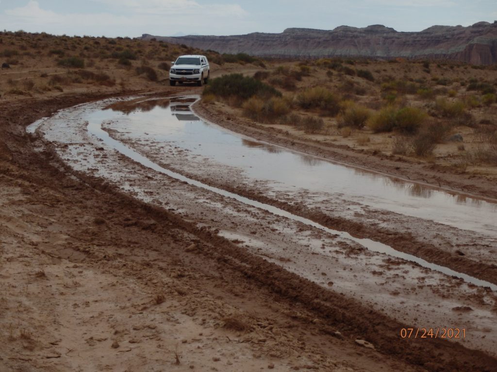
By Saturday, mid-afternoon, a flash flood warning had been issued for Iron and Washington Counties as well as areas including Kolob Canyon and Zion National Park, where flash flooding was reported near the Virgin River.
A Flash Flood Warning is in effect for parts of Zion National Park, where flash flooding has been reported around the Virgin River. #utwx https://t.co/Mm7a4qgjod
— NWS Salt Lake City (@NWSSaltLakeCity) July 24, 2021
The following video contains language which may be offensive to some.
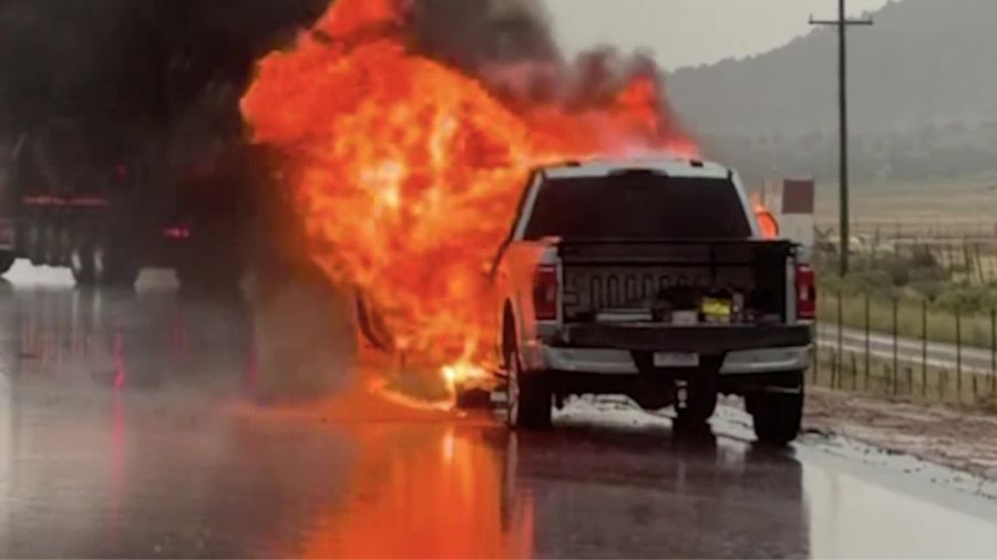
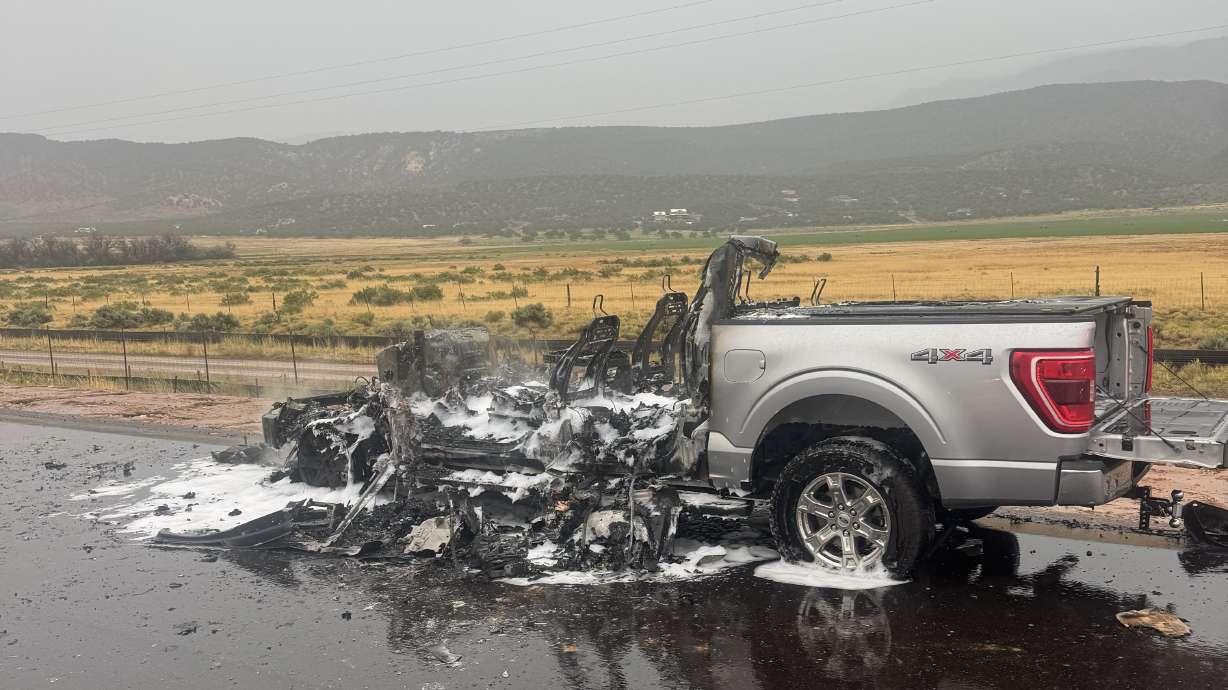
Forecasters point out that most flash flood deaths occur in vehicles and advise that if you see water over a road, you should never try to drive across it.


