More hazardous driving conditions expected on Tuesday
Feb 21, 2022, 6:54 PM
Several snowstorms have caused wear and tear on the tires of vehicles around the state. What should you do if your tires are bald? Dave and Dujanovic had Jake Burt, of Burt Brothers, to discuss the situation. Photo credit: Shara Park, KSL
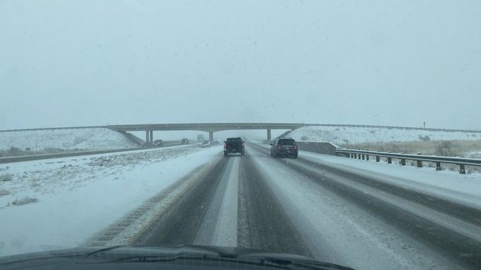
SALT LAKE CITY — The winter snowstorm that moved through Utah on Monday made for some hazardous driving conditions, especially in central and southern Utah.
And if that wasn’t enough, there’s more to come.
Hazardous driving conditions
The National Weather Service out of Salt Lake City (NWS) says another storm will arrive in Utah Tuesday afternoon. The NWS says a significant winter storm will bring moderate to heavy snow to central and southern Utah through Wednesday.
The NWS says if you are planning travel through the central or southern parts of the state during the storm, to plan ahead and give yourself extra time.
Hazardous driving conditions are expected on all area routes including the following:
- US-89 all the way to the Utah-Arizona border.
- I-15 through Black Canyon Ridge.
- SR-24.
- I-70 to Green River
⚠️Significant winter storm to impact much of central and southern Utah including St. George Tuesday afternoon into Wednesday evening.
Traveling? Prepare now for widespread winter driving conditions. #utwx pic.twitter.com/CmGzpVFRKu
— NWS Salt Lake City (@NWSSaltLakeCity) February 21, 2022
Strong winds in northern Utah
While it appears, the snow will miss the northern end of the Wasatch Front, those at the north end of the state will be dealing with the wind.
According to the NWS, wind gusts of 50 mph are expected Tuesday night in Farmington, Weber and Ogden canyons. Winds will increase Tuesday night and will continue into Wednesday morning.
The NWS says property damage from these winds are possible.
Read more:
- Is your vehicle ready for winter? UDOT has tips to assure the answer is yes
- Winter weather brings hazardous driving conditions overnight