
Winter storm set to impact millions stretching from the West Coast all the way to Maine this week
Feb 22, 2023, 6:00 AM
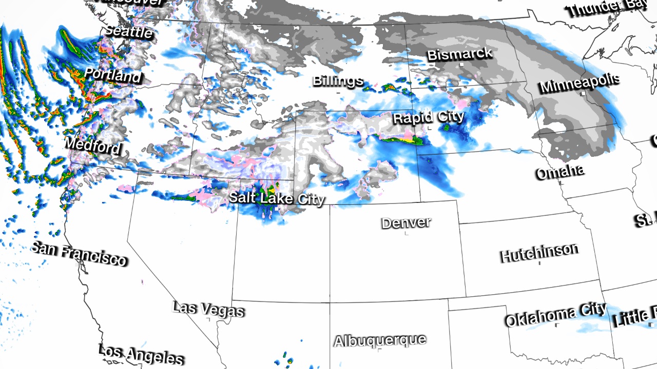
A massive winter storm poised to lash much of the US this week. Photo credit: CNN Weather.
(CNN) — A massive winter storm bringing a mix of heavy snow, rain and gusty winds is poised to lash much of the US West and North this week and has put more than 60 million people across 28 states under winter weather alerts Tuesday.
At the same time, it will feel more like early summer across the Southeast and up into the Midwest, as nearly 150 million Americans will see a high above 70 degrees this week. The contrast across the country will be stark, as highs in the Dakotas will be below zero and highs in central Florida surge into the 90s.
High winds already were whipping parts of California Tuesday afternoon and evening, coinciding with tens of thousands of power outages in the Golden State, many of them in the San Jose area.
The winter alerts, meanwhile, stretch from the West Coast through the Midwest and to the New England coast. The main impacts Tuesday have been in the West and Midwest, including Minnesota, where historic snowfall totals are possible in the Minneapolis area by Thursday.
Lower elevations across parts of Northern California could see up to 6 inches of snow. And interior valleys can expect to see a lighter mix of rain and snow, the weather service added.
In addition to the snow, wind gusts of 50 to 60 mph are expected to impact a large swath of the West, and some places could see up to 80 mph gusts, the weather service said.
In California, power outages rose as strong winds swept in. More than than 160,000 homes and businesses were without power as of 6:40 p.m. local time Tuesday, according to PowerOutage.us. The most outages were reported in Northern California’s San Mateo County, where wind gusts rose above 50 mph, and neighboring Santa Clara County, which includes San Jose, where gusts above 40 mph were recorded Tuesday evening.
The heaviest snow through Tuesday afternoon was across the northern Rockies. Numerous locations across western Montana got more than 18 inches of snow in a 24-hour period, including Dupuyer with 32 inches, and Copper Camp with 20.
Widespread totals of 2 to 6 inches fell through Tuesday afternoon across northern Minnesota, Wisconsin and northern Michigan, especially around Lake Superior.
A blizzard warning is in place for portions of Wyoming, Colorado, South Dakota, North Dakota, Iowa, Minnesota and Wisconsin, according to the weather service.
“As impressive as the snowfall event will be across the West, potentially even more impressive and impactful will be the blizzard that is expected to develop from the High Plains through the Upper Midwest, especially Wednesday and Thursday,” the Weather Prediction Center wrote in a forecast discussion Tuesday morning.
“By late Tuesday night and more exceptionally on Wednesday, the major winter storm will take shape and spread tremendous snowfall, both in coverage, rates, and amounts, across the High Plains and Upper Midwest.”
Snowfall rates of 1 to 2 inches per hour are possible on Wednesday. This combined with strong winds of 40 to 50 mph will create blizzard conditions which will make travel across the region difficult to impossible and could lead to power outages.
In Minneapolis, the snowfall is expected to be historic this week, as multiple rounds through Thursday are forecast to bring accumulation of more than 2 feet — with the addition of strong wind gusts of 50 mph by Wednesday.
The storm could become one of the top three all-time snowfall events for Minnesota, the prediction center warned.
The first round of snow Tuesday could bring up to 7 inches of snowfall in Minneapolis. The second snowfall round is expected to begin Wednesday afternoon and last through Thursday, when another 10 to 20 inches could fall. The three-day total could be between 18 and 25 inches.
Overall, a wide area across the Midwest can also see between 1 and 2 feet of snow through Thursday, with some areas possibly topping 2 feet.
Rain is also expected
As part of the same system, rain and thunderstorms are forecast across the Midwest and Plains late Tuesday night into Wednesday, the prediction center said. The Upper Midwest could also see heavy rainfall and severe storms beginning Wednesday.
A slight risk for severe storms, Level 2 of 5, exists Wednesday for central and eastern Oklahoma, much of central Missouri and parts of western Illinois — areas that include Oklahoma City, Tulsa and St. Louis, the Storm Prediction Center said. The main threats are damaging winds and a possible brief tornado.
A marginal risk for severe storms, Level 1 of 5, surrounds the slight risk areas and extends from northern Texas to western Indiana.
The storms can also bring heavy rainfall from eastern Oklahoma and western Arkansas through Missouri to northern Illinois, southern Michigan, northern Indiana and northern Ohio.
The heaviest rainfall is likely to be from northeastern Missouri to southwestern Michigan, where 2 to 4 inches of rain are possible.
Summerlike temperatures elsewhere
Meanwhile, temperatures could hit February record highs across the Southeast, Tennessee Valley, Ohio Valley and mid-Atlantic.
High temperatures across the region will climb well into the 70s and 80s beginning Tuesday before peaking on Thursday, and cities across the Florida peninsula could reach into the 90s. These temperatures are running 20 to 35 degrees above normal and are typically highs seen in May or early June.
From Tuesday to Friday, more than 130 cities could set new daily high temperature records and some could even set new monthly records, including Atlanta, Orlando, Birmingham, Charlotte and Richmond.


