Winter weather advisory in effect for much of Utah
Feb 21, 2022, 7:30 AM | Updated: 7:51 am
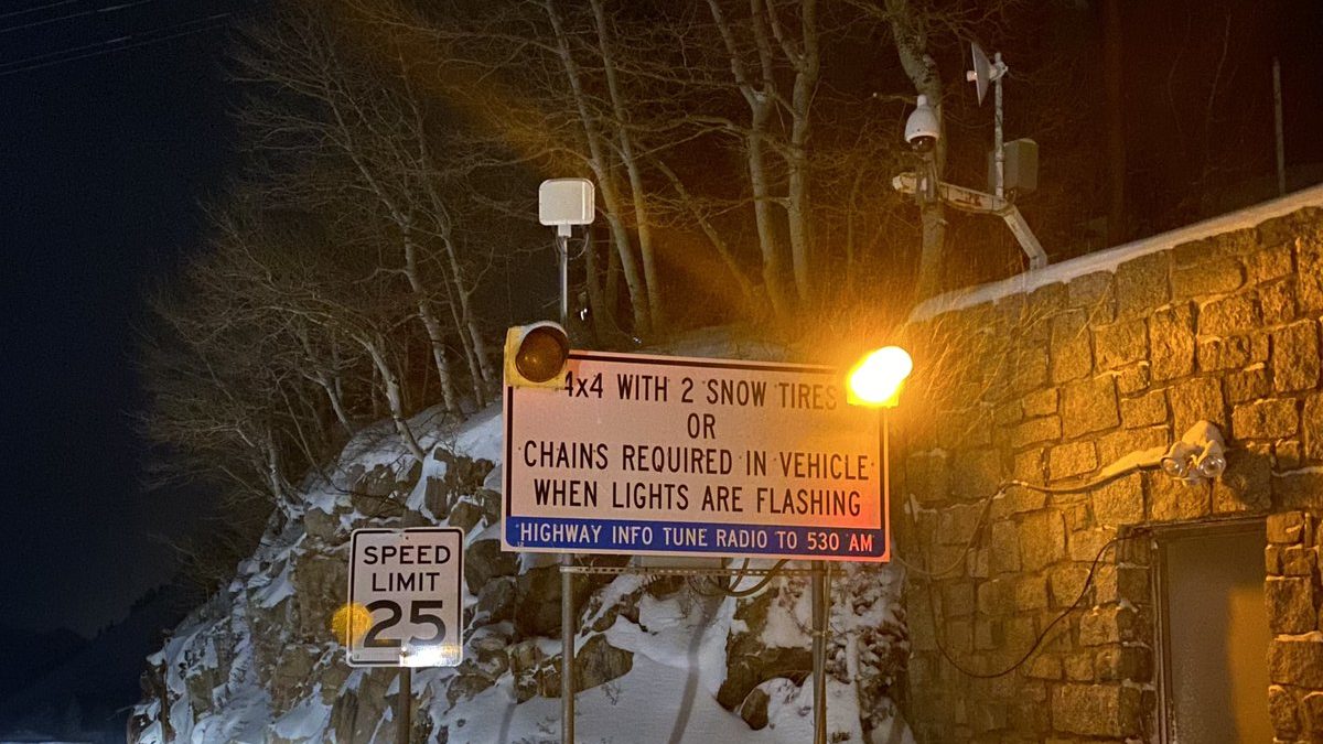
Image of UDOT sign flashing at the mouth of Big Cottonwood Canyon. Photo credit: UDOT

SALT LAKE CITY — Winter weather arrived in northern Utah just in time for the morning commute on Monday. Northern Utah is expected to receive from one to three inches of snow from this storm, with more accumulation in the mountains.
By 7 a.m., traction laws were in effect for those driving up Big and Little Cottonwood Canyons in Salt Lake County.
🚨 #RoadWeatherAlert 🚨
The #TractionLaw is in effect for both Big & Little Cottonwood Canyons. #SR190 #SR210 @UDOTTRAFFIC @UDOTRegionTwo @AltaCentral @AltaSkiArea @SnowbirdAlerts @SolitudeMTN @BrightonResort @UPDSL @BrightonUT @alta_of pic.twitter.com/B2QIkzOLxb— UDOT Cottonwood Canyons (@UDOTcottonwoods) February 21, 2022
KSL Meteorologist Grant Weyman said that Utah County and southern areas of the state may see more snow accumulations from this storm, which he expects to continue through Wednesday.
Here are the forecast snowfall totals for Sunday evening through Tuesday morning. Confidence is generally high in these ranges except for Salt Lake, Tooele, and Utah Valleys where the band could set up further north (increasing totals) or further south (decreasing totals). #utwx pic.twitter.com/KM6MHcMV3K
— NWS Salt Lake City (@NWSSaltLakeCity) February 20, 2022
Snow has been falling at the office since ~4:30am. This line of snow extends from south of Wendover to Ogden to Evanston. North of this line won’t see much more. #utwx
— NWS Salt Lake City (@NWSSaltLakeCity) February 21, 2022
Early Monday morning, Alta Ski Resort advised skiers that unless they had a parking reservation already, they’d have to find another way to get themselves up the mountain, including catching a ride with someone who already has a reservation or taking a bus.