Hot, dry, smoky, windy weather in Utah
Sep 5, 2017, 9:51 AM | Updated: 9:51 am
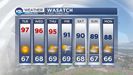

SALT LAKE CITY — We shouldn’t be in these upper 90s temperatures. It’s September but it is just still so hot.
“It was a nice cool morning; at least we were starting out in the 60s. But it zooms up pretty quickly in the afternoon,” said KSL Meteorologist Grant Weyman.
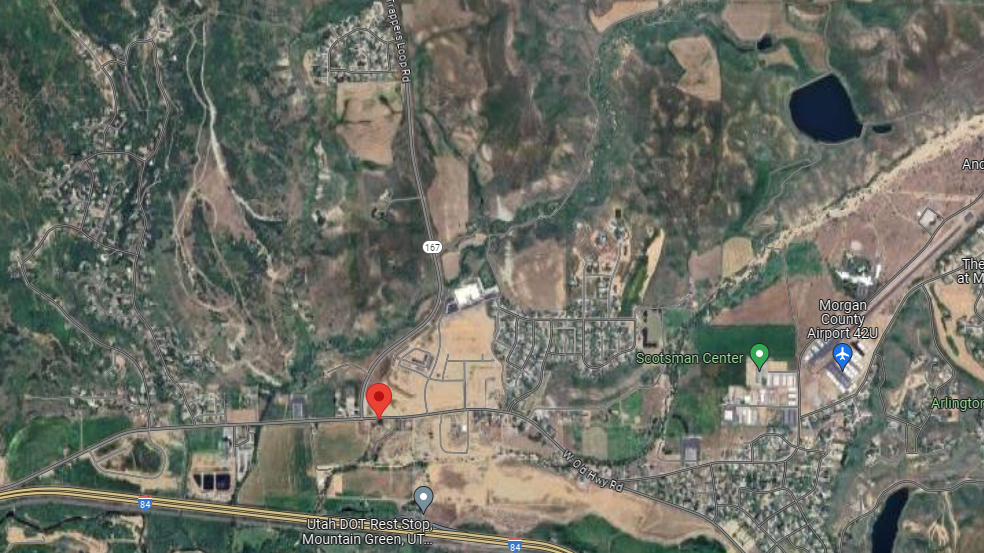
And the wind is a story Tuesday morning, whipping up a grass fire at the mouth of Weber Canyon.
Gusty E winds this AM along Wasatch Front canyons. Strongest at canyon mouths. Red numbers are current gusts in mph, 47 at Parleys #utwx pic.twitter.com/YrS7THIhgQ
— NWS Salt Lake City (@NWSSaltLakeCity) September 5, 2017
Weyman says it may not cool down until early next week. Afternoon clouds and mountain storms come back this week.
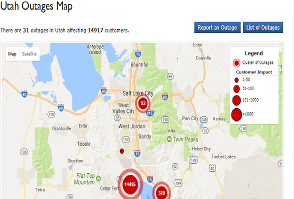
St George saw a micro burst and hail Monday afternoon. Lightning strikes may have caused the power outages throughout Utah County Tuesday morning.
And the air quality won’t be good Tuesday. The National Weather Service in Salt Lake City says smoke from the northern fires is making it into Northern Utah.
Smoke from Northern fires apparent in satellite imagery. Unfortunately some of this smoke will make it into Northern Utah tomorrow #utwx pic.twitter.com/3EAi7NLPLb
— NWS Salt Lake City (@NWSSaltLakeCity) September 4, 2017