
More flash flood warnings and severe weather for weekend
Jul 29, 2021, 9:28 AM
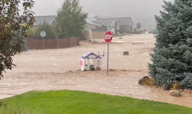
Flooding in Cedar City washes into the roadway and carries away a toy house. Trace Estes
We have seen severe weather up and down the state. From lightning, dust devils, power outages and flooding warnings, and there is more in the forecast.
People in many areas are preparing for more flooding.
Slow moving storms capable of producing heavy rainfall are expected late this afternoon and overnight into the early morning hours Friday for portions of southern Utah.
Heavy rainfall may result in flash flooding, especially in dry washes, slot canyons, and small streams. #utwx pic.twitter.com/20vixHDZFq
— NWS Salt Lake City (@NWSSaltLakeCity) July 29, 2021
Cedar City and Moab have had flash flooding and power outages. The warnings continue for Grand and San Juan Counties. People should stay away from low-lying roads and sidewalks where water can pool.
Now Lehi residents are preparing for possible flooding problems. The Traverse Fire left a big burn scar, and if rain comes down too fast, it will send mud and debris down the mountain into people’s homes.
The forecast calls for the potential of more severe weather bringing more showers and storms Thursday, Friday and Saturday.
But the storms have a different kind of pattern — some places barely get a drop, while others have downpours. KSL Meteorologist Kristen Van Dyke says the storm clouds will mainly gather over the mountains, but as the weekend progresses the rain will go into the valleys.
She says there’s a good dose of monsoonal moisture in the air, so expect the potential for heavy rains in storms that develop.
It’s muggy! That means there’s a chance for more storms this afternoon. Here’s the hourly forecast for the Wasatch Front today: Storms will produce heavy rain with flash flooding possible in burn scars and over favored terrain. #utwx pic.twitter.com/jLp61ddhFF
— Kristen Van Dyke (@kvandykewx) July 29, 2021


