Tornado hits Montezuma Creek, after tornado, flash flood and other warnings issued for parts of Utah
Sep 13, 2025, 12:01 PM | Updated: 5:55 pm

A photo taken of a tornado that touched down in Blanding on Sept. 13, 2025. (San Juan County)
(San Juan County)
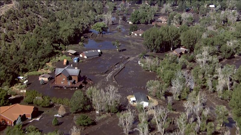
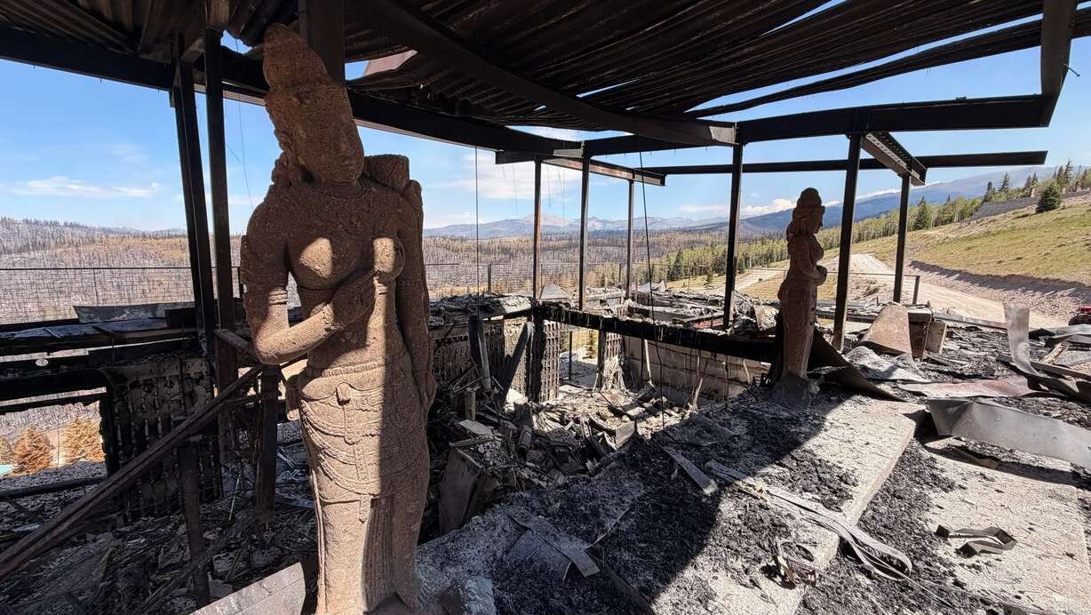
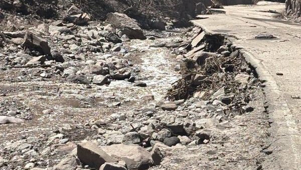
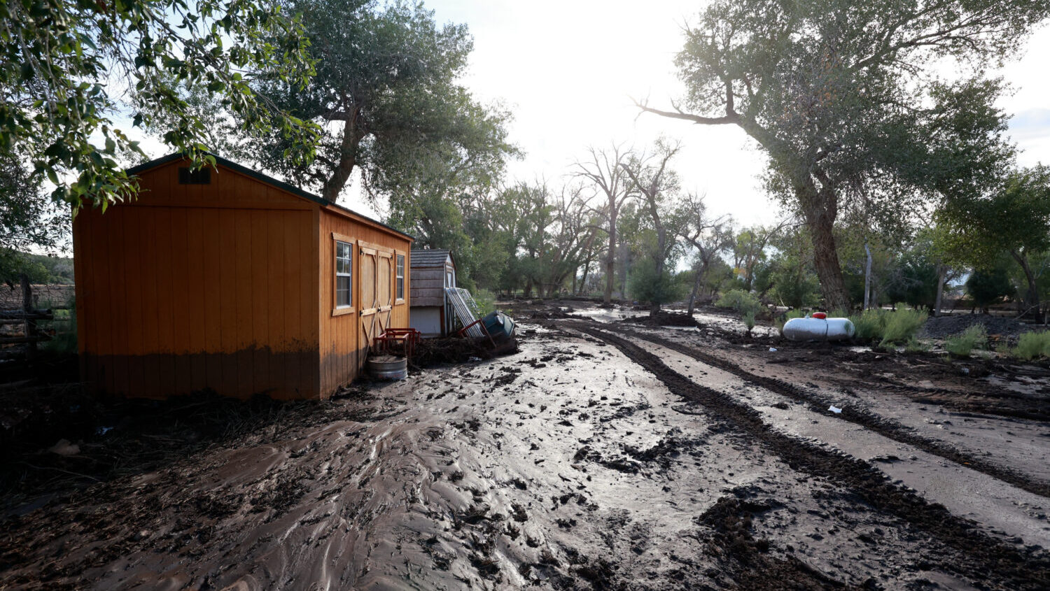
SALT LAKE CITY — A series of storms moving through Utah on Saturday have the potential to cause flash floods, especially for areas affected by fires, with burn scars which are more likely to flood or cause mudslides.
Tornado strikes Montezuma Creek
San Juan County Administrator Mack McDonald confirmed that a tornado touched down on Saturday near Montezuma Creek, on Navajo Nation land.
The National Weather Service confirmed that a tornado touched down in Utah at 1:29 p.m. 13 miles northeast of Montezuma Creek, and that the tornado was moving northeast at 10 miles per hour.
Tornado Warning including Montezuma County, CO, San Juan County, UT until 1:45 PM MDT pic.twitter.com/0U23le1x1m
— NWS Tornado (@NWStornado) September 13, 2025
McDonald said that structure damage was reported, but he was unable to comment on the extent of the damage.
According to McDonald, both the high school and elementary school in Montezuma Creek are open for anyone needing shelter.
Flash flood warning
The NWS issued a flash flood warning for East Central Emery County in Central Utah on Saturday from 10:39 a.m. to 1:45 p.m.
A thunderstorm has already been reported by the NWS to have produced between 2.5 and 4 inches of rain, and could produce around one to two more inches.
“Flash flooding is ongoing or expected to begin shortly,” the NWS stated in its warning.
According to the warning, Saleratus Wash near Green River is likely to experience flash flooding.
“Be aware of your surroundings and do not drive on flooded roads,” the NWS said. “Remain alert for flooding even in locations not receiving rain. Dry washes, streams, and rivers become raging killer currents in a matter of minutes, even from distant rainfall.”
Flood watch
The National Weather Service issued a flood watch through the evening on Saturday for southeastern Utah.
“Recent burn scars, including Deer Creek, Lee, Elk, South Rim, Turner Gulch, and Stoner Mesa, will be the most susceptible,” the NWS stated in its warning.
Southwest and west-central Colorado was also included in the flood watch warning.
Wind gusts
The National Weather Service said on Saturday that portions of southern Sanpete, west central Emery and northeastern Sevier Counties could be affected by high winds starting at 11:30 a.m.
The NWS stated in its warning that wind gusts could get up to 50 miles per hour. A storm running through the areas could produce hail the size of pennies.
The warning includes parts of Interstate 70, and Utah Route 10. The NWS said in an X post that hail hitting I-70 could produce hail the size of peas.
Hazardous weather
East central Utah, northeast Utah, and southeast Utah are part of a hazardous weather outlook issued by the NWS.
According to the NWS, scattered showers and storms will run through the morning into Saturday night.
“Some storms could be strong to severe with large hail, damaging winds, and flash flooding the primary threats of the strongest storms,” the NWS stated. “Fresh burn scars, saturated soils and steep terrain will be especially conducive to flash flooding and debris flows.”
Northwest Colorado, southwest Colorado, west central Colorado were also included in this weather alert.
“Drier conditions move in Sunday behind the departing storm system with fall-like temperatures,” the NWS said. “Terrain-based storms will be possible mid week as a disturbance moves across the north.”
This story may be updated as more information becomes available.