Advisories issued as storm brings valuable snow, snaps southern Utah’s long dry stretch
Jan 24, 2025, 4:00 PM
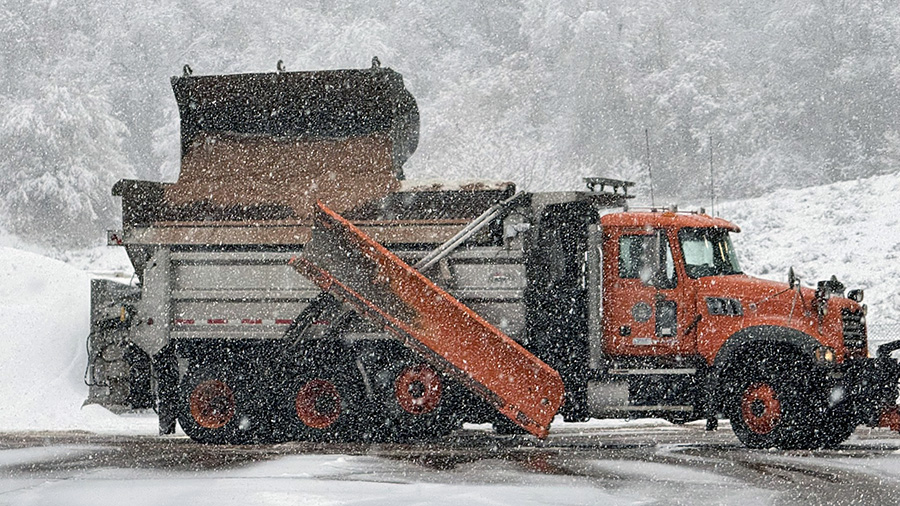
FILE - A snowplow in Little Cottonwood Canyon as the storm hits the road. (Utah Department of Transportation)
(Utah Department of Transportation)
SALT LAKE CITY — The National Weather Service on Friday issued multiple winter weather advisories ahead of a storm that’s projected to deliver much-needed snow after a lull in activity.
It’s also projected to snap a dry stretch in southern Utah that has now exceeded 50 days.
“One of the things we’re looking forward to is adding to the numbers because we’re falling behind,” said KSL meteorologist Matt Johnson, pointing to snow depths that have now fallen below normal statewide this month. “We’ve got to get things going.”
Storm timing
The latest storm is coming in from the Pacific Northwest, but it’s acting differently from previous storms. It will drop down the Pacific Coast before moving eastward, Johnson said. A few snow showers are possible in the Wasatch and West Uinta mountains Friday afternoon, while clouds thicken up across northern and central Utah ahead of the next storm coming in.
A snow band toward the north end of the system is forecast to roll in late Friday or early Saturday, intensifying by mid-Saturday morning as it stalls out somewhere by the Wasatch region. It’s expected to produce some valley snow across the Wasatch Front and parts of central Utah.
Weather models suggest that an area from about Salt Lake City to Nephi has the highest probability of receiving snow from the band. It’d also extend out into the Wasatch Back and western Uinta Basin. However, the National Weather Service said there’s about a 20% probability that the heaviest band could extend as far as Delta.
It all depends on where the front stalls.
“Outside of that area, you’re going to see lesser amounts or maybe even get skipped,” Johnson said, adding that light snow showers will remain at points throughout the day as the front remains in place before diminishing sometime around late Saturday and early Sunday.
Periods of light snowfall are expected across most of Utah and southwest Wyoming from late Friday into early next week. There are some uncertainties in the forecast, detailed in this graphic. Overall, snow totals are expected to remain on the lighter side areawide. #utwx #wywx pic.twitter.com/ZwZipYCKOH
— NWS Salt Lake City (@NWSSaltLakeCity) January 23, 2025
While the snow band is forecast to fall apart in northern Utah, moisture from another part of the system is projected to move north into southwest Utah by Sunday afternoon, possibly impacting areas like St. George and Brian Head. Storms are forecast to continue into early next week.
Snow accumulations
The first half of the storm will mainly impact Utah’s northern half. The winter weather advisories cover the Wasatch Mountains south of I-80, as well as the West Uinta and central mountains, Wasatch Back and western Uinta Basin. Mountain areas within that zone are now forecast to receive 5 to 10 inches of snow, where areas closer to Provo Canyon could receive up to a foot.
Wasatch Back and western Uinta Basin communities could receive up to 2 to 6 inches of snow — and possibly more in some areas, according to the advisories.
KSL Weather models project 0 to 1 inches across northern Utah and the northern Wasatch Front, while a trace to 3 inches is projected along the southern half of the Wasatch Front and into central Utah. Johnson said it appears that Utah County could be the “bull’s-eye” this time around.
Meanwhile, the second half of the storm could produce about 2 inches near Cedar City and almost a half-foot at Brian Head early next week. St. George could also experience a rain-snow mix from the system.
“It’s not a ton of snow, but it is something,” Johnson said.
Storm impacts
The Utah Department of Transportation issued a road weather alert for the storm, advising drivers to use “high caution” when traveling through the Wasatch Back and western Uinta Basin on Saturday. Blowing and drifting snow may impact travel along I-80, especially by Echo Canyon near Wyoming.
Drivers are urged to slow down and drive carefully.
❄️ Road Weather Alert ❄️
SR-190 & SR-210 PLAN AHEAD:Thru 6am (1/25): Snow showers will turn to consistent snow after midnight. Lower canyon will see 1-2″ & upper canyon near the resorts will see 3-5″.
Thru 6pm (1/25): Snow continues all day expect 3-6” road ❄️through canyons pic.twitter.com/MetkmN7hI2
— UDOT Cottonwood Canyons (@UDOTcottonwoods) January 24, 2025
The storm will also snap a lull in storm activity that developed after Utah’s northern half experienced a busy end to 2024 and start to 2025. Many of its snowpack basins had running totals above 100% of normal earlier this month, but those numbers have now fallen back to below normal for the final week of January because this month hasn’t kept up with the normal.
The statewide snowpack dropped from 101% of its median average on Jan. 7 to 80% as of Friday morning, according to the Natural Resources Conservation Service. Most basins across Utah’s northern half are now running 80-100% of their respective median averages, aside from the Northeast Uintas, which is standing at 104%.
It could also deliver some of the highest snowfall totals in some valley areas this season. Places like Provo have only collected 4.2 inches of snow since Oct. 1, 2024, which is over a foot below its average.
Meanwhile, it would snap a dry stretch in southwest Utah that emerged after Thanksgiving. The Southwestern Utah basin has only collected 1.4 inches of snow water equivalent this season, which is 24% of its median average and its lowest late Jan. 24 total since at least 1982.
Washington County commissioners called on residents to continue to reduce water consumption and pray for rain last week with how bad the conditions have gotten in the region.
About 95% of the state’s water supply comes from the mountain snowpack collection and spring snowmelt process.
Full seven-day forecasts for areas across Utah can be found online, at the KSL Weather Center.