Another round of severe weather rolls through northern Utah
Aug 21, 2021, 7:17 PM | Updated: 9:55 pm
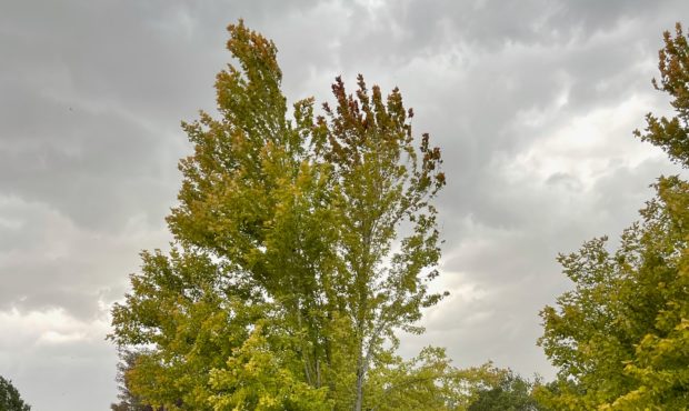
Severe thunderstorms rolled through northern Utah on Saturday, Aug. 21, 2021. The storm brought down a tree branch onto a car in Kaysville. Photo credit: Kristin Nilsen

SALT LAKE CITY — Another round of severe weather rolled through northern Utah Saturday evening.
The storm arrived in some parts of the Watch Front just after 6 p.m. According to the National Weather Service (NWS) out of Salt Lake City, the storm was expected to produce wind gusts of up to 70 miles per hour from Brigham City on down to South Jordan. The damaging winds were also felt as far west as Grantsville and up into Morgan.
Travel on I-80 turned hazardous with the storm. The NWS reported dust was being blown across parts of the interstate as the storm moved west. Wind gusts between 50 and 70 miles per hour were recorded on I-80 west of Salt Lake City.
An Urban and Small Stream Flood Advisory was issued Saturday evening for parts of Davis, Weber and Morgan counties. It was set to expire at 9:30 p.m.
In all, the NWS issued severe thunderstorm warnings from Tooele into portions of western Wyoming.
The storm also left many people in the dark. Power outages were reported in Ogden, Harrisville and Bountiful. The power in Bountiful was restored about an hour later.