Storm system coming may bring problems, cooler temps and cleaner air
Aug 17, 2021, 9:05 AM
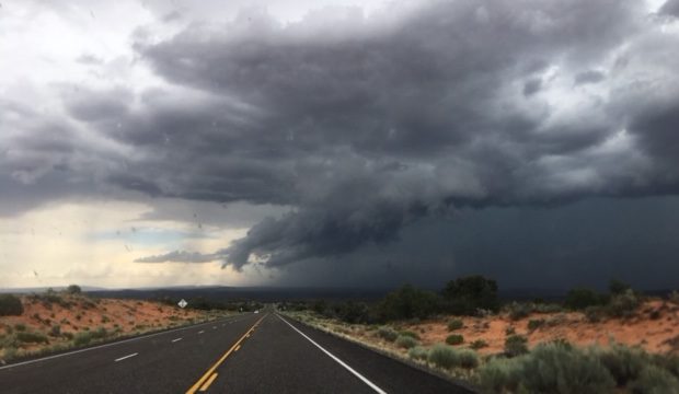
FILE: Storm clouds over southern Utah on July 14, 2018.

SALT LAKE CITY — We’ve got a storm system coming into Utah Tuesday and it could bring big problems. It also means we will cool way down, see some cleaner air, and even some snow in the mountains.
The big problems, the forecast calls for hail, and torrential downpours.
There’s a flash flood watch for much of the state. If the rain comes down too fast, it could cause problems on hillsides, burn scars, dry streams and slot canyons.
There’s also a red flag warning for a lot of Utah, too. If the storms come with lightning, it could mean new wildfires could start.
But more moisture from the storm system coming, could also help fire suppression efforts in Parleys Canyon.
Forecasters say the storms and cold front Tuesday through Thursday will cool the temperatures down by around 20 degrees. The smoky air should clear out. And high elevations like the Uinta Mountains could see snow.
Today is a day we will see hail across the state. Reporting hail based on sizes on this chart is really helpful for us! Let us know when you see hail and use this chart for reference to tell us the size. #utwx pic.twitter.com/yKa6Oy0jvC
— NWS Salt Lake City (@NWSSaltLakeCity) August 17, 2021
Rounding out the threats for Tuesday, a Flash Flood WATCH has been issued for portions of southern and central Utah. Notably, burn scars in central Utah and slot canyons in southern Utah are at highest risk. #utwx pic.twitter.com/FP8wgPInD7
— NWS Salt Lake City (@NWSSaltLakeCity) August 16, 2021
First on deck for Tues: thunderstorms after a long stretch (approx. 2 weeks) of dry weather across portions of the forecast area will create critical fire weather conditions. A Red Flag Warning has been issued in these areas for 12PM – 9PM Tuesday. #utwx pic.twitter.com/sorWSgipLv
— NWS Salt Lake City (@NWSSaltLakeCity) August 16, 2021
Weekly Mon good/bad:
Bad:
-Hot today and Tuesday
-Breezy ahead of cold front
-Smoke remains for at least a couple more daysGood:
-Much cooler Wednesday and beyond
-widespread showers tues ngt – thurs
-additional showers possible this weekend
-Snow possible in Uintas!!!!!!!!— Wasatch Snow Forecast (@WasatchSnow) August 16, 2021
Big temp drop with rain on the way! pic.twitter.com/WE28D0Evni
— Grant Weyman (@KSLweyman) August 17, 2021
Look at rain amounts possible by Friday pic.twitter.com/spALf73THl
— Grant Weyman (@KSLweyman) August 17, 2021